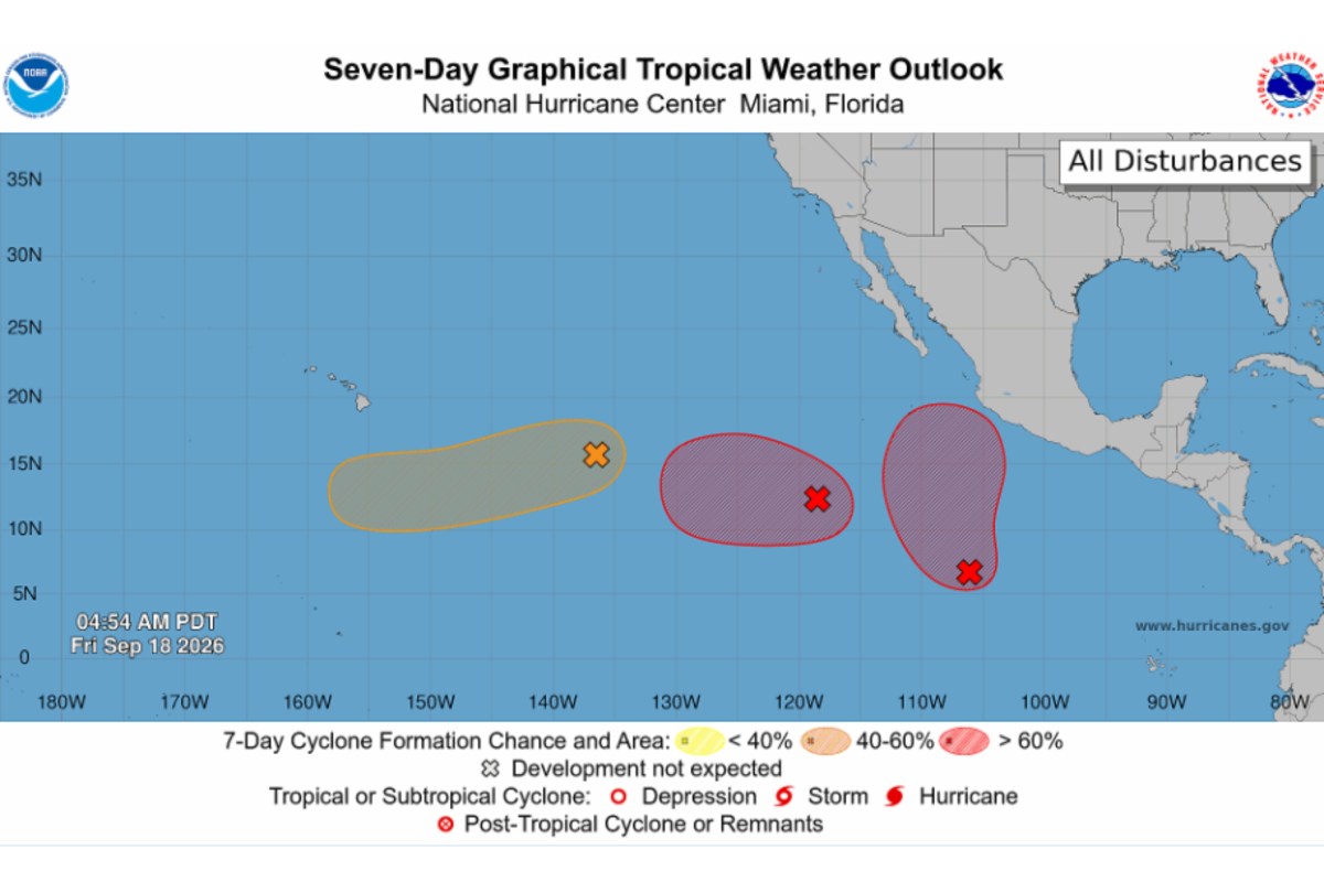
Forecasters are watching several areas for possible tropical development across both the Atlantic and Pacific, though the odds of formation vary considerably among them. As of Friday morning, two areas were being tracked in the Atlantic, although neither had more than a 30 percent chance of developing over the next seven days, according to the National Hurricane Center (NHC). The agency was also observing three systems in the Eastern Pacific, including two it said were likely to become tropical depressions within a week.
In the eastern subtropical Atlantic, the NHC said a trough of low pressure several hundred miles southwest of the Azores was producing showers and thunderstorms which had begun to show some signs of organization. Conditions were expected to remain just marginally favorable for supporting further development in the coming days as the system ambles over the area, though conditions next week are expected to become less favorable, it said. The agency gave a 20 percent chance of development within 48 hours and a 30 percent chance over the next seven days.
Farther west, an area of low pressure designated AL98 was still being tracked east of Bermuda early on Friday, although that system is no longer expected to develop. AccuWeather lead hurricane expert Alex DaSilva told Newsweek this was due to hostile winds and dry air. Development chances were higher for some systems being watched in the Pacific.
A disturbance designated EP98, located well southwest of the southern tip of the Baja California Peninsula, could spawn a tropical depression over the weekend as it travels west across the western Eastern Pacific at around 10 to 15 miles per hour, the agency said. As of reporting, the NHC gave a 60 percent chance of formation through 48 hours, but an 80 percent chance over the next seven days. East of EP98, a low-pressure area was producing “disorganized” shower and thunderstorm activity.
During the next seven days, it has an 80 percent chance of cyclone formation, with a 20 percent chance through 48 hours. Farther west, the remnants of a previous tropical depression could redevelop, according to the NHC, with a 10 percent chance through 48 hours and a 40 percent chance through seven days as of reporting. A tropical depression is a tropical cyclone with maximum sustained winds of 38 mph or less, according to the NHC.
If its winds strengthen to 39 to 73 mph, it becomes a tropical storm and receives a name. A system is classified as a hurricane once its maximum sustained winds reach 74 mph or higher. Forecasters previously indicated that the Pacific could see more activity than average this year, thanks partly to the effects of El Niño conditions.
Extract — continue reading at the source.