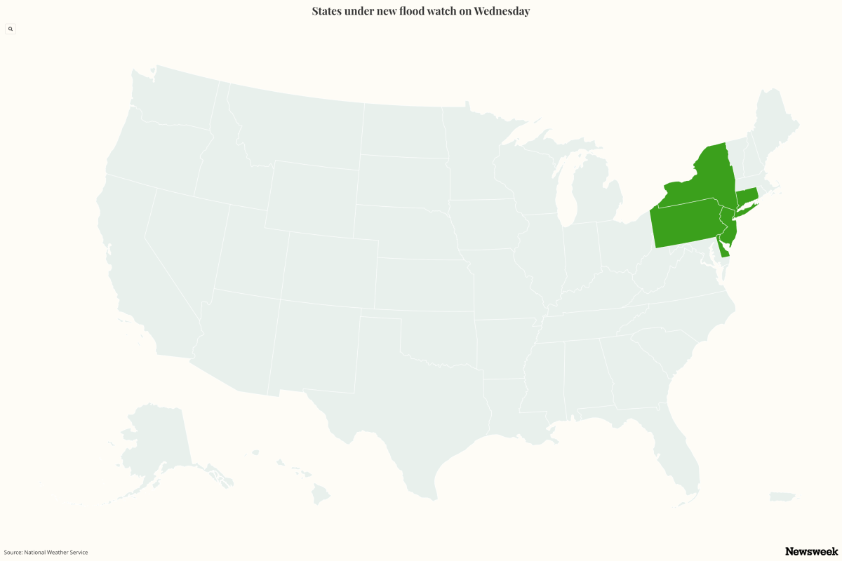
Flood watches have been issued across parts of the Northeast, with forecasters warning that rounds of heavy rain and thunderstorms could trigger flash flooding in densely populated urban corridors stretching from the Philadelphia region to New York City and southern Connecticut. The National Weather Service (NWS) said some areas could see several inches of rainfall in just a few hours, raising concerns about flooded roads, overwhelmed drainage systems and rapidly rising waterways. The watches cover portions of Delaware, New Jersey, Pennsylvania, New York and Connecticut and are in effect from Thursday afternoon into Thursday night as a storm system moves through the region.
One flood watch issued by the NWS office in Mount Holly, New Jersey, covers northern Delaware, central and northern New Jersey, and southeastern Pennsylvania. Areas included in the watch encompass Wilmington, Philadelphia, Camden, Trenton, New Brunswick, Morristown and surrounding communities. The watch begins Thursday afternoon and continues through late Thursday night.
A separate flood watch issued by the NWS office in New York covers portions of southern Connecticut, northeastern New Jersey and southeastern New York. Included are New York City, Brooklyn, Queens, Staten Island, the Bronx, Nassau County, Westchester County, Rockland County and parts of Fairfield County, Connecticut. That watch is in effect from Thursday afternoon through Thursday evening.
The flood watch prompted a text alert from the New York State Office of Emergency Management on Wednesday afternoon. According to the Mount Holly forecast office, showers and thunderstorms are expected to develop by midday Thursday and may produce torrential rainfall. Widespread totals of 1 to 2 inches are forecast, but localized areas could receive 3 inches in the strongest storms.
Such rainfall amounts falling within a short period can rapidly overwhelm storm drains and lead to dangerous flash flooding, particularly in urban and low-lying locations. Animated weather footage from windy.com shows some rain accumulation across the region over the next three days. Forecasters in New York warned that most locations within the watch area could receive around 1 to 1.5 inches of rain, while isolated communities may see as much as 3 inches.
Peak rainfall rates could reach 1.5 to 2.5 inches per hour beneath the heaviest thunderstorms. The NWS Weather Prediction Center has also highlighted parts of the Mid-Atlantic and Northeast for excessive rainfall potential, reflecting the increased risk that thunderstorms could generate runoff sufficient to cause flash flooding. "On Thursday, the severe thunderstorm shifts to the Northeast and Ohio Valley, while the heavy rainfall/flash flooding threat encompasses portions of the Northeast, Mid-Atlantic, and Southeast as the frontal boundary moves eastward," the WPC said in a forecast on Wednesday.
Extract — continue reading at the source.