A nor’easter storm could bring hurricane-force gusts, heavy rain, and flooding impacts to portions of the East Coast this weekend, according to forecasters. The National Weather Service (NWS) explains that a nor'easter is a storm along the East Coast of North America where winds over coastal regions usually come from the northeast. These storms can form at any time of year but are most common and powerful between September and April.
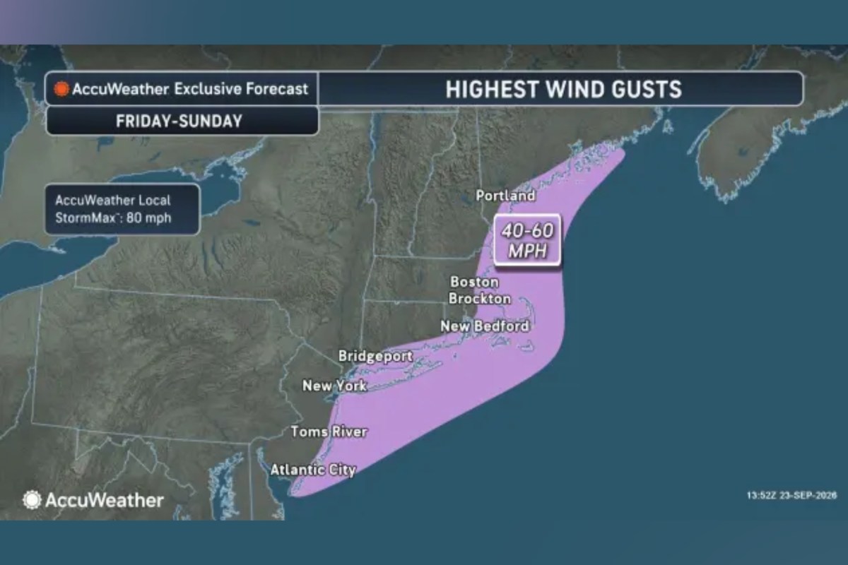
Such systems “nearly always” bring heavy rain or snow, as well as gale-force winds, rough seas and occasional coastal flooding, according to the agency. The system could bring coastal flooding, damaging winds and power outages to parts of the East Coast, with some of its most severe effects expected in New England this weekend, according to an AccuWeather forecast. The forecaster said southeastern New England would be affected from Friday and into Sunday, with the strongest winds and heaviest rainfall anticipated between Friday night and Saturday night.
Rhode Island, central and eastern Massachusetts, eastern Connecticut, southeastern New Hampshire and Maine’s southern coast are expected to experience the worst winds and rain, it said. AccuWeather warned that the potentially hurricane-force winds could raise the possibility of downed trees and power disruptions. The outlet forecast general rainfall totals of one to two inches from northeastern New Jersey to coastal Maine, with higher amounts in parts of southeastern New England.
Between four and eight inches could fall from central Massachusetts to Cape Cod, Nantucket and Martha’s Vineyard, it said. The storm is also expected to push Atlantic water toward the shoreline, leading to water accumulations in bays, sounds, harbors and inlets from Long Island to Maine, AccuWeather said, adding that low-lying coastal areas could flood, while periods of heavy rain may inundate streets and small streams and disrupt travel across southeastern New England. Farther south, coastal flooding was forecast by AccuWeather from North Carolina to New York through Friday.
The outlet said southeastern Virginia could experience the worst conditions, while some locations could see water levels approaching six feet above the average monthly tide level. As of Thursday morning, gale warnings from the NWS span much of the East Coast. Flood-related alerts also spanned several East Coast states, including Virginia, Delaware, Maryland, and New Jersey.
The NWS Mount Holly/Philadelphia forecast office said on X, Thursday that coastal flooding in its forecast area was expected to worsen with each passing high tide through at least Friday night. Contact Newsweek editors on this story: Matthew Robinson and Emma Lee-Sang
Extract — continue reading at the source.