A rapidly strengthening El Niño is raising the possibility of one of the strongest such climate events on record, potentially reshaping winter weather patterns across the United States and around the globe. Forecasters have been closely tracking El Niño's development for months using a network of ocean buoys, satellites, atmospheric observations and computer climate models that monitor sea-surface temperatures and shifting wind patterns across the tropical Pacific. Scientists say the warming is expected to continue into the fall and winter, raising the likelihood of significant impacts on weather patterns worldwide and increasing confidence that this year's El Niño could rank among the strongest observed in modern records.
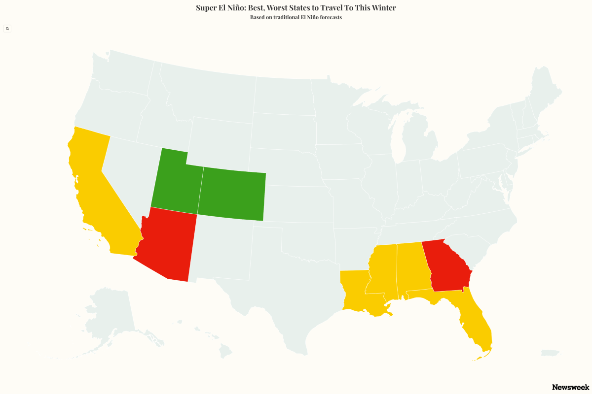
While the National Oceanic and Atmospheric Administration (NOAA) officially classifies the current event as a "very strong" El Niño rather than a "super" El Niño, many meteorologists use the informal "super" label for exceptionally intense episodes that exceed certain ocean temperature thresholds. For winter travelers, that distinction may matter less than the weather impacts that could follow, ranging from flooding rains in parts of California and the Southwest to severe storms in portions of the Southeast. El Niño is the warm phase of a natural climate cycle known as the El Niño-Southern Oscillation (ENSO), which occurs when sea surface temperatures in the central and eastern tropical Pacific rise above average.
The warming can alter atmospheric circulation patterns worldwide, influencing rainfall, temperatures, storms and droughts. NOAA does not officially recognize a "super" El Niño category. Instead, the agency classifies events as weak, moderate, strong or very strong based on ocean temperature anomalies.
Meteorologists and climate researchers, however, often use the term "super El Niño" informally to describe exceptionally powerful events such as those seen in 1982-83, 1997-98 and 2015-16. The current El Niño is already among the strongest observed for this time of year. NOAA says there is more than a 90 percent chance it will reach "very strong" status this fall and winter, and a 69 percent chance it could exceed the strength of all El Niño events on record dating back to 1950.
One reason forecasters are paying close attention is the extraordinary warmth already present in the Pacific Ocean. NOAA says the ocean-atmosphere system increasingly reflects a strengthening El Niño, with sea surface temperature anomalies exceeding 2 degrees Celsius in parts of the eastern equatorial Pacific. Scientists have also pointed to record global ocean temperatures and a large reservoir of unusually warm subsurface water that has accumulated beneath the Pacific.
That heat has helped fuel the rapid intensification seen during 2026. Still, NOAA cautions that a stronger El Niño does not automatically guarantee stronger impacts everywhere. El Niño's strongest and most widespread effects are typically felt during the fall and winter months, when warming Pacific Ocean waters have fully developed and begin to more strongly influence global atmospheric circulation and seasonal weather patterns.
Extract — continue reading at the source.