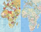
The UN general assembly will vote on Friday on a resolution for the world to formally phase out the traditional Mercator map of the globe in favour of one that more accurately displays Africa’s size. Robert Dussey, Togo’s foreign affairs minister, said the resolution was sponsored by Togo and backed by countries including the African Union’s 54 other member states. He did not specify the total number.
UN resolutions are non-enforceable but if the vote passes, it could lead to an update of classroom curriculums and everyday technology, given the wide usage of the Mercator projection in education, technology and governance. The layout was introduced by the Flemish cartographer Gerardus Mercator in 1569 to help sailors navigate the seas. Almost five centuries later it remains the global standard.
Because of its projection style, however, regions near the equator appear significantly smaller than they are, whereas high-latitude areas look much larger. For example, the map shows Africa as being similar in size to Greenland, but the continent is 14 times larger than the Danish territory. The African Union endorsed the campaign in August 2025 and then asked Togo to spearhead its adoption.
Historians and geographers have said for years that the Mercator projection is rooted in western stereotypes. Activists have echoed this, with some coining the term “cartographic colonialism”. Some argue that the map has subtly shaped international power dynamics by minimising the physical presence of the global south and visually inflating northern hemisphere nations while shrinking equatorial regions.
This, they say, has reinforced systemic biases in international trade, development priorities and educational frameworks. One of the Mercator projection’s most prominent critics was Arno Peters, a German historian, who launched the Peters world map based on the Gall–Peters projection in 1973. It has often been used as an alternative to the Mercator map.
Togo’s #CorrectTheMap campaign is promoting the use of the more accurate 2018 Equal Earth design, which was developed by an international team of cartographers. Supporters say it will help to reverse perceptions of Africa and decolonise global curriculums. JJ Enoch, a London-based senior associate at JS Held, a geopolitical risk advisory firm, said the Mercator projection visually diminished Africa’s true scale.
Extract — continue reading at the source.