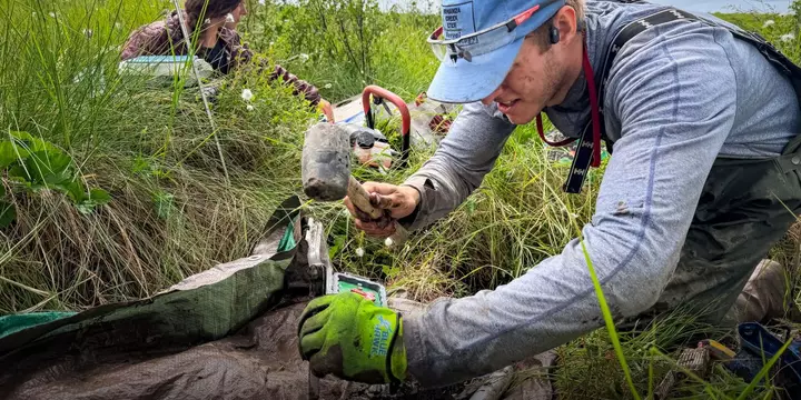
Andrew Haverdink, a tall grad student in a rain bib and rubber boots, wrenched a double-handed drill from the frozen soil that underlies much of Alaska’s Denali National Park and then unclipped the hollow barrel from the end of the bit. He knelt in front of a blue tarp, lined the barrel up with a plastic tray, and pushed a rod through the opposite end. A perfect solid, cylindrical core of ancient soil emerged—dark, rich permafrost at least a foot long.
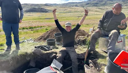
On that late morning in early July, Haverdink was among a team of Northern Arizona University students and staff gathering samples and data from a research plot, divided by surveyor’s tape unspooled atop tussocks, alders, and fireweed. In late June of 2013, a lightning strike sparked a fire in this stretch of mostly treeless tundra, in the northern backcountry of the park. Whipped by the Chinooks, intense downslope winds created as moist ocean air surmounts and then descends the Alaska Range, the fire ripped across nearly 35,000 acres.
It burned through much of the vegetation and deep into the topsoil, stripping away the insulating layer that preserves the frozen permafrost, a massive storehouse of carbon that underlies 85% of Alaska. During their first survey, in 2016, the researchers found that in places where the fire burned hottest and deepest, the thawed soil above the permafrost (known as the active layer) extended between a foot and nearly two feet deeper than in plots outside the burn scar—an indication of deep thawing. Crucially, the fire also crossed two sets of survey grids that the National Park Service established in 2001, including the one where the researchers stood that morning.
That pre-fire snapshot offered the Northern Arizona group a rare opportunity to study how the blaze has altered the vegetation, carbon, and permafrost across time, says Xanthe Walker, one of the principal investigators on the project, who was watching over Haverdink’s work that morning. These direct observations from high-latitude fires are helping scientists to better understand the impacts of wildfire and permafrost loss on climate change, she says. The work is providing critical clues into the complex mechanisms driving cascading climate feedback effects: As warming temperatures fuel more frequent and severe fires, more permafrost thaws, releasing greenhouse-gas emissions that threaten to fuel more warming, fires, and permafrost loss.
Understanding just how powerful these effects are, how they compound, and to what degree other transformations of the landscape may mitigate them is essential to gain a clearer picture of our climate future. Notably, past modeling suggested that the carbon dioxide uptake from expanding trees and plants may largely offset the release of carbon from warming soils and melting permafrost, at least over long periods and under moderate levels of warming. But the improving observations and analyses have revealed worrisome signs about the impacts of rising Arctic-boreal emissions in the immediate decades ahead, as the world struggles to keep global warming within relatively safe boundaries.
Permafrost makes up 15% of the land surface of the Northern Hemisphere and holds about 1.5 trillion tons of carbon, roughly twice the amount in the atmosphere. Most of it formed during the last ice age, but it’s been thawing at an accelerating rate during the last half-century, amid rising temperatures and worsening fires. As it melts, microbes begin to break down that organic matter, releasing it into the air in the form of carbon dioxide and methane.
Extract — continue reading at the source.