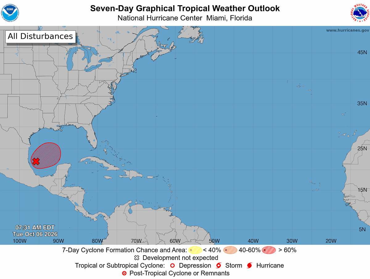
A tropical disturbance in the Gulf of Mexico is expected to develop into Tropical Storm Isaias within the next couple of days as forecasters closely monitor its path toward the United States. The system could bring flooding rain, storm surge, damaging winds and isolated tornadoes to portions of the Gulf Coast later this week. Communities from eastern Louisiana to the Florida Panhandle are being urged to follow forecasts as confidence increases that the storm will approach the northern Gulf Coast by Friday or Saturday.
The National Hurricane Center is monitoring Invest 92L in the Bay of Campeche and has assigned it a high probability of tropical development. Hurricane Hunter aircraft are scheduled to investigate the disturbance as meteorologists work to determine how quickly it strengthens and where it ultimately comes ashore. NOAA's current forecast track and model guidance indicate the northern Gulf Coast remains the area of greatest concern.
Recent spaghetti model guidance shows a notable clustering of tracks across the northern Gulf Coast, with many solutions bringing Isaias ashore somewhere between eastern Louisiana and the Florida Panhandle. While individual models vary on the exact landfall point, forecasters say the consensus has become increasingly focused on that stretch of coastline. Meteorologist Matt Devitt said Tuesday that the greatest potential for landfall currently appears to be from eastern Louisiana eastward to the Florida Panhandle.
Confidence is growing that Isaias will move toward the northern Gulf Coast, according to AccuWeather Lead Hurricane Meteorologist Alex DaSilva. "There is still a low chance that the storm could slow down and meander in the Bay of Campeche, but that chance is shrinking," DaSilva told Newsweek. While forecast uncertainty remains, AccuWeather's latest projection places the highest risk along portions of Mississippi and Alabama's coastline.
"The areas most at risk for landfall would be coastal Mississippi and coastal Alabama. We currently have landfall Saturday morning just east of Biloxi, MS," DaSilva said. He added that forecasters should gain greater confidence in the storm's timing and exact landfall location once a defined circulation develops.
"Once a more well-established center of circulation forms during the next 24 hours, we should have more confidence on landfall timing and location." The spread among models reflects lingering uncertainty about where the storm's center will form and how quickly it organizes, but several forecast tracks have shifted away from Mexico and toward the U.S. Gulf Coast over the past 24 hours. Spaghetti models should not be interpreted as a prediction of impacts at a single point.
Extract — continue reading at the source.